A housing development near the Santa Ana River recently faced a costly setback when grading work exposed loose alluvial sands that washed into storm drains after a single heavy rain. The contractor had no prior soil erosion analysis, so the extent of the problem only became clear when the city issued a stop-work order. That's exactly the kind of situation a thorough evaluation can prevent. In Riverside, where the terrain transitions from flat valley floors to steep box canyon hillsides, unaddressed erosion can undermine foundations, clog drainage infrastructure, and even trigger debris flows. A proper study quantifies soil loss rates, identifies critical slopes, and guides the design of control measures that keep the site stable through wet seasons.
Erosion rates on Riverside's decomposed granite slopes can exceed 30 tons per acre per year without proper cover—ten times the tolerable soil loss threshold.
Method and coverage
Riverside's modern growth has pushed development into the surrounding alluvial fans and granitic foothills. Those deposits, while easy to excavate, are highly erodible when stripped of vegetation. A sound soil erosion analysis measures the detachment and transport potential of the site's specific soil types—from the sandy loams of the Santa Ana River plain to the decomposed granite of the Box Springs Mountains. The methodology follows ASTM D6459 for silt fence installation design and uses the Revised Universal Soil Loss Equation (RUSLE2) to predict sheet and rill erosion rates. When the site includes steep cuts, we combine this with a slope stability study to evaluate whether the erosion could progress into a shallow landslide. For projects adjacent to arroyos or detention basins, we also recommend a permeability field test to understand infiltration rates and subsurface flow paths.
Technical reference image — Riverside
Regional considerations
Riverside sits in a semi-arid climate with intense, short-duration winter storms that can drop 1.5 inches of rain in a few hours. When that happens on a graded site without a proper soil erosion analysis, the consequences are immediate. The topsoil—often less than 6 inches thick over the granitic parent material—washes away, exposing the underlying weathered rock that cannot support vegetation regrowth. Beyond the environmental compliance issue with the Santa Ana Regional Water Quality Control Board, the owner faces re-grading costs that can run tens of thousands of dollars. In subdivisions near Lake Mathews or the San Jacinto Wildlife Area, off-site sediment transport also triggers Clean Water Act violations, leading to fines and mandated restoration plans.
We run site-specific simulations using the Revised Universal Soil Loss Equation and the Water Erosion Prediction Project model. Input parameters include local rainfall records from the Riverside Municipal Airport weather station, soil survey data from NRCS, and field-measured slope profiles. The output quantifies annual soil loss in tons per acre and identifies the erosion-prone zones that need priority protection.
02
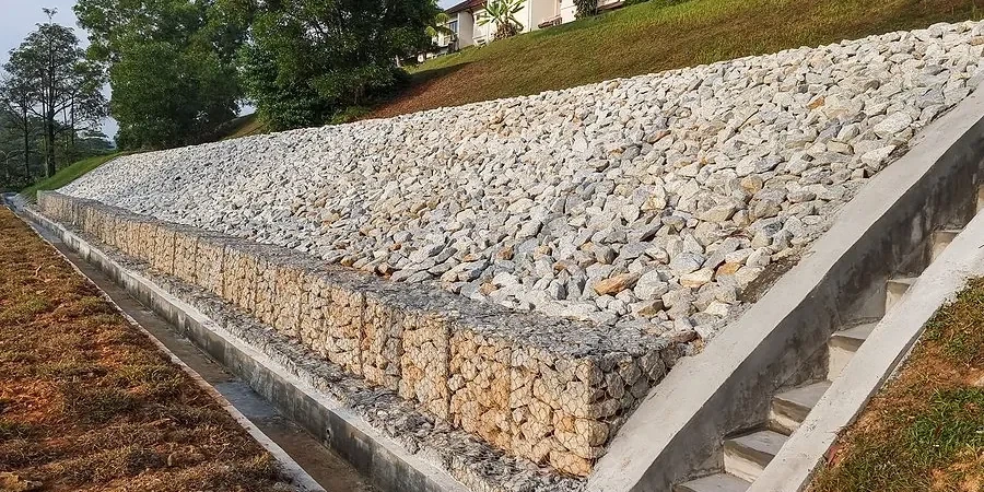
Sediment Basin & Silt Fence Sizing
Based on the drainage area and the sediment delivery ratio calculated during the erosion analysis, we determine the required storage volume for temporary sediment basins and the maximum spacing for silt fences. The design follows ASTM D6459 and the California Construction General Permit requirements, ensuring the control measures capture the predicted sediment load during a 10-year, 24-hour storm event.
Standards that apply
ASTM D6459 – Standard Test Method for Determination of Rolled Erosion Control Product (RECP) Performance, ASTM D6460 – Standard Test Method for Determination of Rolled Erosion Control Product Performance in Protecting Earthen Channels, IBC 1803.1 – Geotechnical Investigation requirements addressing erosion and sediment control, NPDES Construction General Permit (CGP) – Federal stormwater discharge regulations
Q&A
How does soil erosion analysis differ from a standard geotechnical report?
A standard geotechnical report focuses on bearing capacity, settlement, and soil strength for foundation design. A soil erosion analysis specifically evaluates the detachment and transport of soil particles by water or wind, using models like RUSLE2. It provides the data needed to design erosion control measures, size sediment basins, and comply with NPDES stormwater permits. Many Riverside projects require both, but they serve different regulatory and design purposes.
When is the best time to perform a soil erosion analysis for a Riverside project?
Ideally, the analysis is done during the pre-construction phase, before any grading begins. That allows the design team to incorporate erosion control measures into the site plan and avoid late-stage redesign. For Riverside, the analysis should account for the October-to-April rainy season. If grading occurs in summer, we can still run the model using historical rainfall data, but a field visit after the first winter storm helps validate the predictions.
What is the typical cost range for a soil erosion analysis in Riverside?
The cost for a professional soil erosion analysis in Riverside typically ranges between US$920 and US$2,480, depending on the size of the site, the number of drainage basins analyzed, and whether field infiltration tests are included. A single-family lot on a gentle slope falls at the lower end, while a multi-acre subdivision with steep terrain and multiple outfalls sits at the higher end. We provide a fixed-price quote after reviewing the preliminary site plan.